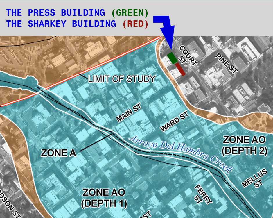
FEMA Flood Map of Downtown Martinez, California
(Map of Flood Zones in Downtown Martinez, California)

Effective as of September 30, 2015 the Federal Emergency Management Agency (FEMA) modified its flood hazard determinations and revised its flood zone maps for Dowtown Martinez. Buildings located within a flood zone that are substantially improved are required to comply with the floodplain management development regulations of the City of Martinez (Chapter 15.30 of the Municipal Code).
There are only a few private commercial buildings in Dowtown Martinez that are not located within a FEMA flood zone. Both "The Press Building" at 610 Court Street and the "Sharkey Building" at 630 Court Street are two of these buildings - they are located outside of the flood areas, meaning that the floodplain management development regulations do not apply.

